Customer
A private company working in the navigation system market.
Objective
The project goal is to create a device designed to bring the user back to the previously marked point in a coordinate system. It should show the movement and indicate the distance to a specified point.
The product’s target audience (TA) includes both young and retired people and outdoor recreation enthusiasts.
TA general description: people who like travelling and hiking and need only a device that would bring them back to a starting point (for example, to their camp location).
The product should have an intuitive interface and should not require any additional settings before the start of operation.
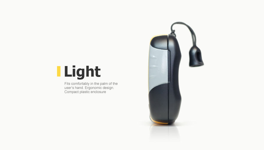
The device should be quite small in size to be easily held in the user’s palm.
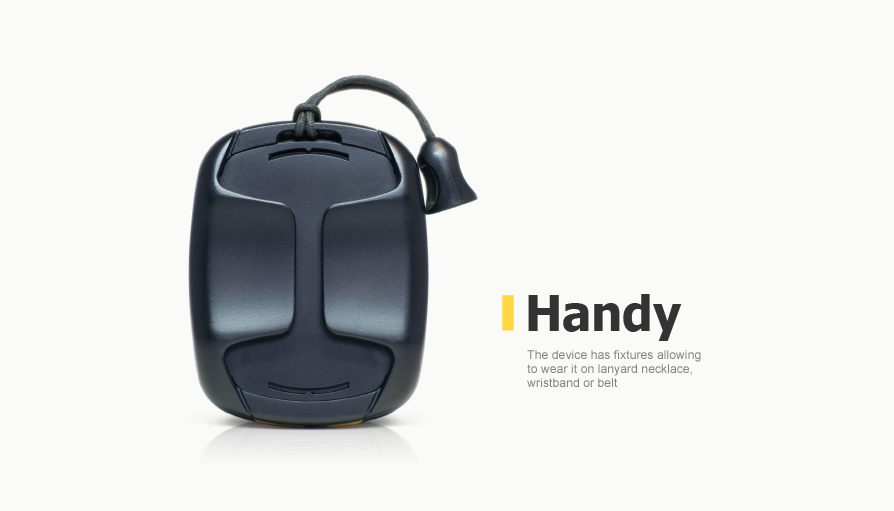
The plastic enclosure should be fitted with fixtures to carry the device on:
- a neck string
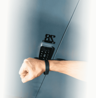
- a wristlet
- a belt
The weight of the device should not make it uncomfortable for the user to carry it on their wrist or neck.
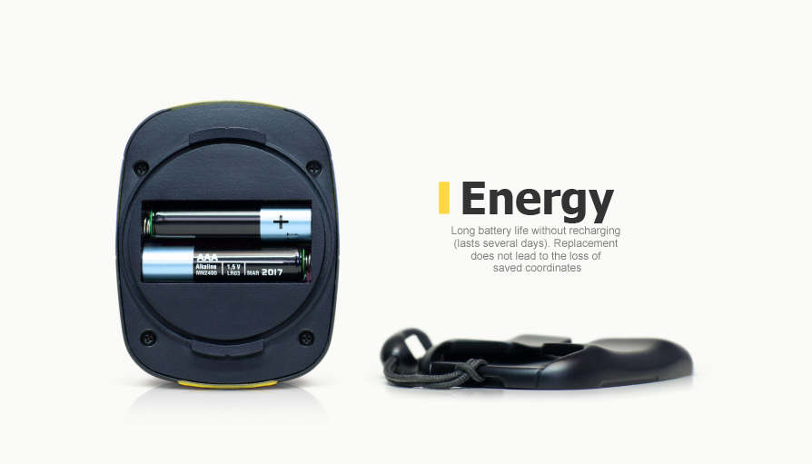
The battery capacity should make it possible to use the device for a long time, up to a few days. In this case, battery replacement should not lead to the loss of the coordinates saved in the device memory by the user.
This device targets the low-end market. The production cost should not be higher than 30 USD for batch of over 10,000 pieces.
Solution
1. Hardware platform
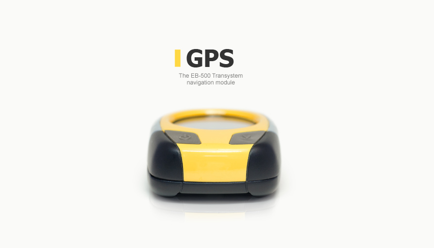
The device uses the EB-500 GPS module by Transystem, based on an MTK chipset. It is small in size and has a low production cost.
The module sends GPS coordinates in the NMEA format to the Freescale MC9S08QE8 microcontroller. This microcontroller has minimal required peripherals and, accordingly, a low cost.
The controller receives the NMEA signals, which are used to determine the distance and the vector of movement to a specified point.
The Honeywell HMC1042L Digital Compass magnetic sensor is used to determine the direction of the device in space. It helps the device serve as a simple compass.
All information about the distance to a specified point and the direction of movement is displayed on a custom-made LCD display manufactured specifically for this device.
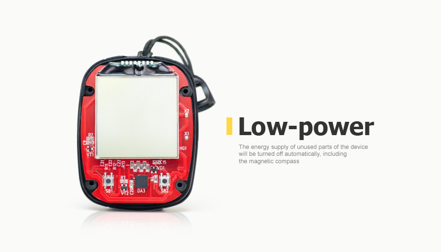
The product’s power consumption was a special focus for developers. To save power, the microcontroller can turn off any part of the device, which is not used. Power for the magnetic compass is supplied only at the time of measuring the position of the device. In addition, the LCD display and the compass are powered through the microcontroller outputs, which helps make a simpler and cheaper circuit as well as fully cut off power from these units. After a long inactive time, the device automatically shifts into the power save mode, turning off the power supply of the GPS module and the compass. The screen shows only the sleep indicator.
2. Software
The product’s software includes subroutines for:
- Deciphering the NMEA lines and converting the coordinates into integer values;
- Calculating the distance and the direction of movement between the points, using simplified integer-value formulas;
- Calculating the magnetic angle, based on the sensor readings;
- Calibrating the magnetic sensor;
- Saving and restoring the location coordinates in the microprocessor memory;
- Other functions performed by information display control subroutines on a custom-made LCD indicator
One of the software features was that the microcontroller had a very limited memory. This led to only integer-value calculations and a large number of optimized distance and direction calculation algorithms. However, the calculation error remained within admissible limits.
3. Product’s Design and User Interface
While developing the enclosure design, we considered a variety of options created to solve this particular problem (small size, ergonomics and different fixation options):
Eventually, we chose the best option which is based on a combination of ease of use, good outward appearance and a potential for further production.
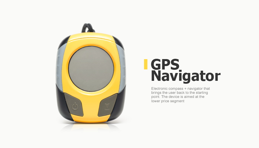
The design of the GPS compass enclosure has a number of color solutions (the most popular designs are shown in the pictures below):
The front side of the enclosure has two keys and this is a minimum of control elements required for the device (to turn it on and off, store location coordinates, use it as a compass, etc.). The keys have intuitive pictograms which show the functions of each key. The enclosure has side riffling for greater convenience.
The components of the graphic user interface (GUI) have an ergonomic design, which makes the LCD screen convenient for displaying all letter commands, device status indicators, numerical values and possible movement directions.
4. Testing
Sample testing has shown that the product’s ease of use depends on the quality of satellite signal reception, which, in its turn, is determined by the position of the antenna relative to the user’s body and hands (the user should not “intercept” signal reception if they carry the device on a belt, a string or in their hands).
Based on the testing results, the device structure has been altered. To improve GPS signal reception, the printed-circuit board has been retraced and the antenna has been shifted to the upper part of the enclosure, which enables free transmission of satellite signals.
Advantages
- Low production cost
- Ease of use
- Low power consumption
- Elaborate ergonomics and modern design
- Compactness
- High-accuracy direction finding
| Design tools | Freescale Codewarrior |
| Interfaces | NMEA |
| Programming languages | С |
| Project management tools | dotProject, SVN |
| Man-day | 6 man-months |
| Project due date | 4 months |

